AL, LA, MS Fishing Spots

How to use Gulf Fishing Spots and what's included
Hey, how's all this work exactly? – With any of our fishing spots for Alabama, Mississippi or Louisiana, you will receive the following package via email, ready to load-import to your GPS or open with your mobile devices. For over a dozen years, we’ve offered our GPS product in (9) nine coastal states. We are the original and only company working with local guides to bring you these fishing spots for one of the best GPS fishing products available. (All "what's included" info listed below)
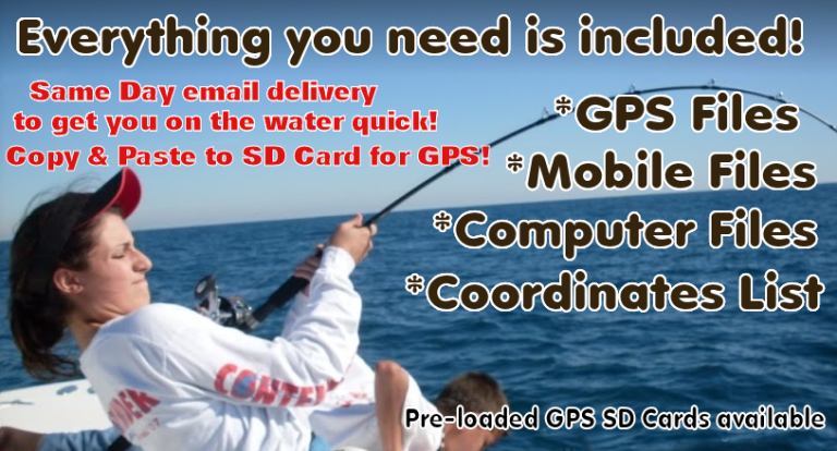
![]() GPS Files included! - All our fishing spots include GPS SD card files compatible with Garmin, Humminbird, Raymarine Hybrid, Lowrance and Simrad GPS models that accept SD cards. This product is a huge time saver! We send these GPS files with any purchased area to match your GPS make and model. Simply copy and paste our file to a blank SD card using a Windows computer (note that GPS files are not Mac compatible, but all other files on this page work with all brands) and load all our fishing spots to your GPS at once. After uploaded to your GPS, all coordinates and their names will show on your GPS Map and in your waypoints list on your GPS. - If you’re not sure about your GPS compatibility, email us your GPS make using our contact form here.. NOTE: Pre-loaded SD cards for your GPS re available! Simply select the SD card option during checkout!
GPS Files included! - All our fishing spots include GPS SD card files compatible with Garmin, Humminbird, Raymarine Hybrid, Lowrance and Simrad GPS models that accept SD cards. This product is a huge time saver! We send these GPS files with any purchased area to match your GPS make and model. Simply copy and paste our file to a blank SD card using a Windows computer (note that GPS files are not Mac compatible, but all other files on this page work with all brands) and load all our fishing spots to your GPS at once. After uploaded to your GPS, all coordinates and their names will show on your GPS Map and in your waypoints list on your GPS. - If you’re not sure about your GPS compatibility, email us your GPS make using our contact form here.. NOTE: Pre-loaded SD cards for your GPS re available! Simply select the SD card option during checkout!
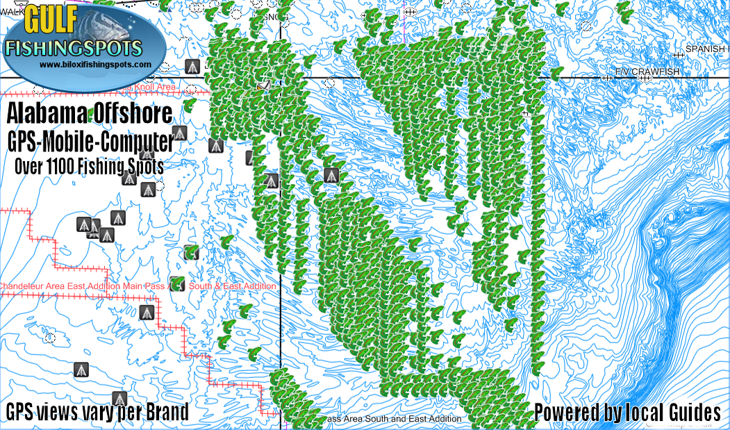
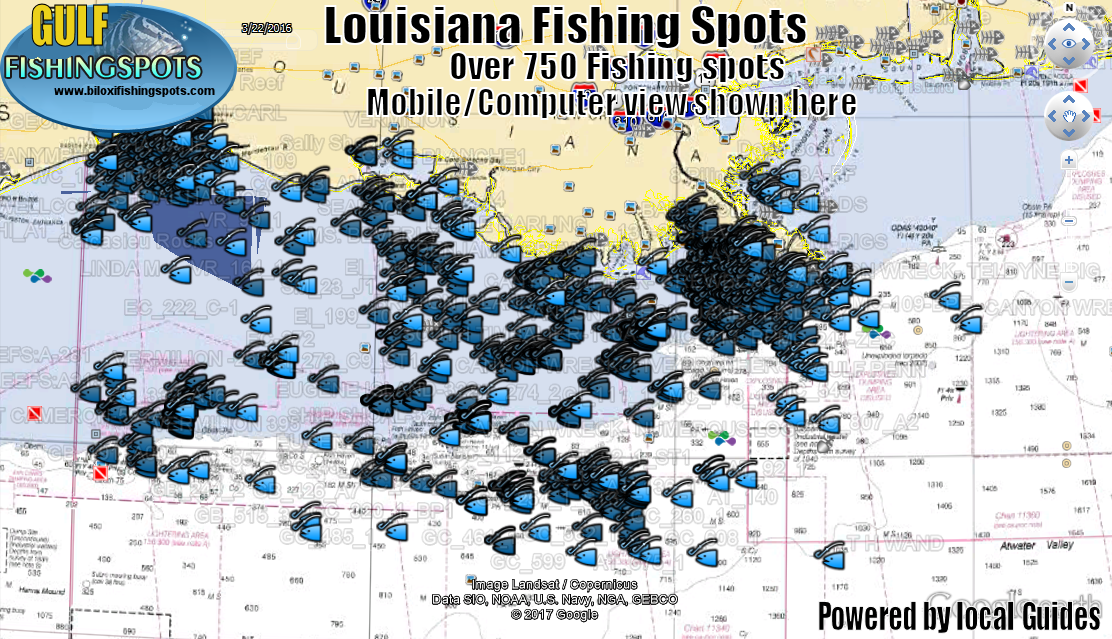
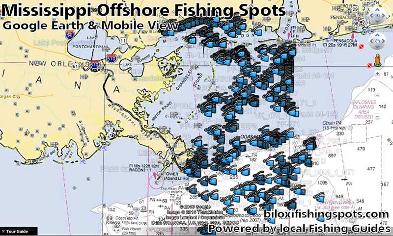
![]() Mobile Files Included! Use your Computer or Mobile devices to see your Fishing Maps and Fishing Spots. Use your mobile device as a secondary GPS for trip planning on the water and off the water with our included Google Earth files! (Always use a marine GPS for navigation) Enjoy the use of seamless NOAA nautical chart and fishing map imagery built in! This included file works with Google Earth and other GPS apps we recommend after purchase. Loads to apps from your email to your computer or your Mobile Devices! Your new fishing spots will be usable, viewable and editable on most any device that uses Google Earth or various GPS apps that support Google Earth files. Note - Sharing the spots is strictly prohibited.
Mobile Files Included! Use your Computer or Mobile devices to see your Fishing Maps and Fishing Spots. Use your mobile device as a secondary GPS for trip planning on the water and off the water with our included Google Earth files! (Always use a marine GPS for navigation) Enjoy the use of seamless NOAA nautical chart and fishing map imagery built in! This included file works with Google Earth and other GPS apps we recommend after purchase. Loads to apps from your email to your computer or your Mobile Devices! Your new fishing spots will be usable, viewable and editable on most any device that uses Google Earth or various GPS apps that support Google Earth files. Note - Sharing the spots is strictly prohibited.
 View comments on your fishing Spots – Many of our fishing spots have comments from our guides which might mention something about that spot.. Sometimes maybe what type of bottom you can expect, possibly fish, or some other clue about that spot. Spot details depend much on the guide providing them. Much of this comment info transfers to your GPS comment section (depending on how your GPS accepts comments) and ALL comments are shown with a simple click or "tap" on the fish head icons when using any of the included Google earth Files on most devices and computers for trip planning! Cool deal, now that's easy!
Matching GPS Coordinates List for viewing or printing your GPS Lat/Long Fishing Coordinates, These printable and viewable GPS Coordinates are label matched and can be entered into most any GPS in the world, if ever needed. Print this and take it with you on the boat, or save the file for safe-keeping in case you ever need it for reference or you find the need for using the lat/long GPS Coordinates for your purchased Gulf Fishing Map.
Gulf Fishing and Rigging Tutorials Upon your request, we can email you tutorials for offshore fishing the Gulf coast for trolling. bottom fishing and how to fish Gulf offshore Oil Rigs. Our guides have come together to compile excellent short tutorials (for those who need them) to include tips on rigging for offshore bottom fishing, rigging and trolling off in Gulf of Mexico.
All the above mentioned files are included with any fishing spots purchased. The files are conveniently emailed to you the same day of purchase to get you on the water fast. Note: For you convenience, these files are sent in 4-5 attachments with your GPS SD Card files found inside a ZIP file for easy handling. The days of paper maps are history my fellow fishermen! ---- FISH ON!
Questions? Email us anytime using the contact form found here